![]() A Professional And Responsible CompanyWe took part in an 8-day Gobi Desert tour with Selena Tr...
A Professional And Responsible CompanyWe took part in an 8-day Gobi Desert tour with Selena Tr...

![]() 5 DAYS FREE AND EASY- Excellent private exclusive tour arrangement, done by Joe (Tour consulta...
5 DAYS FREE AND EASY- Excellent private exclusive tour arrangement, done by Joe (Tour consulta...

![]() Perfect serviceWe hired Selena Travel for a nomadic tour. The task was a bit challenging, sinc...
Perfect serviceWe hired Selena Travel for a nomadic tour. The task was a bit challenging, sinc...

![]() The Gobi Desert, Karakorum and BeyondJust one month ago I returned from one of the best travel...
The Gobi Desert, Karakorum and BeyondJust one month ago I returned from one of the best travel...

![]() Dear Selena Travel team, Thanks again for another fantastic Mongolian tour. Joe was wonde...
Dear Selena Travel team, Thanks again for another fantastic Mongolian tour. Joe was wonde...
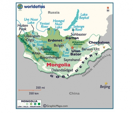
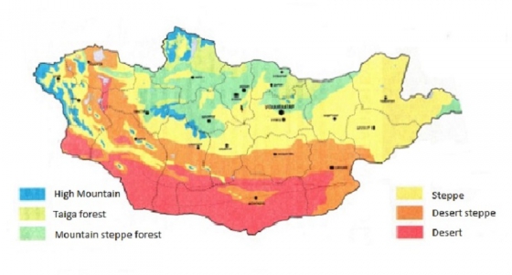
Before your travel in Mongolia, it is important that you know of the geography in Mongolia. This way, you can be well prepared for the climate, weather and ladscape features at your destinations. The northern part of the country is covered with forests and mountain ranges, while the southern holds vast desert, desert steppe, and steppe areas with low mountains.
High snow-capped mountains and glaciers accentuate the west. Broad plains and wild heaths cover the east. The Mongolian environment has a large variety of features, and can be divided into six zones; desert, mountain, mountain taiga, mountain forest steppe, arid steppe and taiga.
A constanstly cold climate with strong winds have preserved the glaciers in the mountain belt of the Mongol Altai, Khangai and Khentii mountainous regions. Traces and signs of ancient ice cover can also be found here. The area is inhabited by some endangered animals:including the Snow Leopard and Altai Snowcock) and plants (such as the Dwarf Siberian Pine and White Gentiana). Roughly 80% of the country is more than 1000 meters above sea level with an average elevation of 1580 meters. The highest mountain is Tavan Bogd in Bayan Ulgii Aimag reaching 4374 meters and the lowest point is Khukh Nuur in the east at just 560 meters.
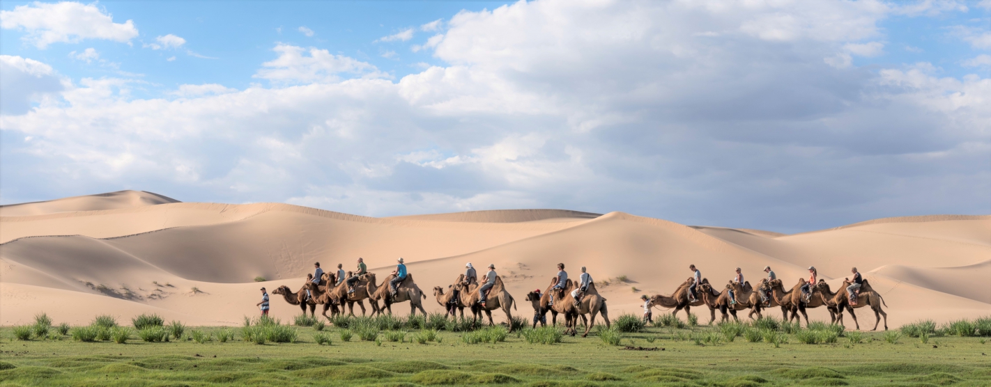
Mountains and dense forests proliferate central and northern Mongolia, with grasslands cover large areas of this region. These grasslands lead across the east and into the Asian Steppe. From there, the steppe leads into the Gobi Desert, which extends throughout southern Mongolia from the east to the west of the country. The Gobi consists of mostly gravel, but also contains large areas covered in sand dunes in the drier areas of Gobi located near the southern border. Scattered throughout the country are numerous saltwater and freshwater lakes.
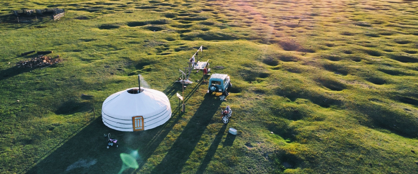
Although it boasts over 260 sunny days a year and is known as the "Land of the blue sky", Mongolia's climate can be extreme. Long subarctic winters are harsh with average tempratures dropping to -34'C (-88'F) in January and early February. Some rivers remain frozen until June. The general landscape of the country is conserved with its natural origin, comparatively less destroyed and impacted by human activities.